5 June 2025
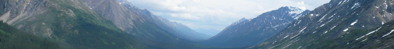
Vancouver, British Columbia--(Newsfile Corp. - June 5, 2025) - Blue Star Gold Corp. (TSXV: BAU) (OTCQB: BAUFF) (FSE: 5WP0) ("Blue Star" or the "Company"), a leading explorer in Canada's North, is excited to discuss it's Roma Main Gold prospect, a target with significant upside potential, located in the West Kitikmeot Region of Nunavut.
Roma Prospect Highlights
"The Roma Main prospect continues to show strong potential as we advance our understanding of the gold system there," said Grant Ewing, CEO of Blue Star. "Surface sampling has returned encouraging grades, including up to 125.6 g/t gold, and historical drilling intersected visible gold with highlights such as 12.83 g/t over 2.31 metres. Our recent work has helped refine the structural interpretation of the target area and identified drill-ready zones for follow-up. We look forward to the next phase of exploration as we systematically assess the broader potential of this underexplored trend. Roma Main represents one of several high-priority discovery targets outside of our core focus area near the Company's Flood Zone gold deposit."
Discussion of the Roma Main Gold Prospect
The prospect is hosted in granodiorite adjacent to the unexposed contact with a volcanic package. The Roma Main prospect extends over a 2 km strike length, and is comprised of three distinct zones: North, Central and Southern Zones. The characteristics of each zone are broadly similar and consist of an auriferous milky quartz vein, with predominantly arsenopyrite as a secondary mineral, and other sulphides including pyrite, chalcopyrite, bismuthinite and specular hematite in minor concentrations. Surface gold grades range from detection limit up to 58.7 g/t in the Northern Zone, 5 g/t in the Central Zone and 125.6 g/t in the Southern Zone. Historical drilling (1991) tested the main vein in all three zones to a maximum vertical depth of 37 metres. Results indicate the vein is up to 1.68 metres wide and bifurcates at depth in the Northern Zone drill holes suggesting a developing vein system. The best intercepts from historical drilling include 12.83 g/t Au over 2.31 metres in 91MD-01 and 8.76 g/t over 1.87 metres in 91MD-03. The two best drill intercepts come from the Northern Zone, where two of the five drill holes intersected visible gold.
Historical Work
The property was first staked in 1989 by BHP to protect an auriferous quartz vein in the Northern Zone. The vein measures up to one metre wide and is exposed in a gossanous cliff face over a strike of 300 metres. Initial surface sampling graded up to 9.0 g/t Au. Subsequent mapping and prospecting led to the discovery of the Central and Southern Zones, where similar veining and mineralization occurred. The Central Zone is located ~700 metres south of the Northern Zone and the Southern Zone is located ~1,600 metres further south. The total combined distance of these zones extends over 2 km. Mineralization is exposed periodically in outcrop and frost-heaved boulders, and where covered, soil sampling suggests the favorable horizon extends between showings. In addition, clusters of mineralized quartz boulders with corresponding soil anomalies located off the main trend have yet to be followed up.
The mineralized quartz veins occur within a granodiorite host rock, often proximal to a sheared volcanic contact and/or to mafic to intermediate xenoliths observed within the intrusive. In 1991 a small geophysical program collected both magnetic and VLF-EM data. The magnetics data identified three distinct susceptibilities over the grids, allowing for discerning volcanic xenoliths within the granodiorite host. The VLF-EM data predominantly reflected faults; however, one weak VLF-EM anomaly appears to be associated with the mineralized trend between the Central and Southern Zones. Max-Min data was collected on selective grid lines; however failed to detect mineralization.